A workflow for earth and planetary geologic mapping in the digital domain
2nd Planetary Mapping and Virtual Observatory Workshop
1-3 July 2019, Domaine de St. Paul, Saint-Rémy-lès-Chevreuse, France
Alessandro Frigeri
Istituto di Astrofisica e Planetologia Spaziali - IAPS
Istituto Nazionale di Astrofisica - INAF
Rome, Italy
alessandro.frigeri@inaf.it / @afrigeri
Interpretative mapping
Interpretative mapping and RS data
In a completely digital domain, we need:
- Spatial registration of dataset
- Information stacking
- Data interactivity (I/O)
GIS offer a useful environment
The craft of a geologic map in a GIS
We need 3 elements:
- Data interoperability
- Digitizing environment
- Graphical rendering (symbology)
Data models
There are 2 models for editing/storing vector data
- Eulerian model: node/boundary
- Points/line/polygon model
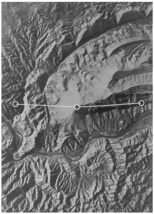
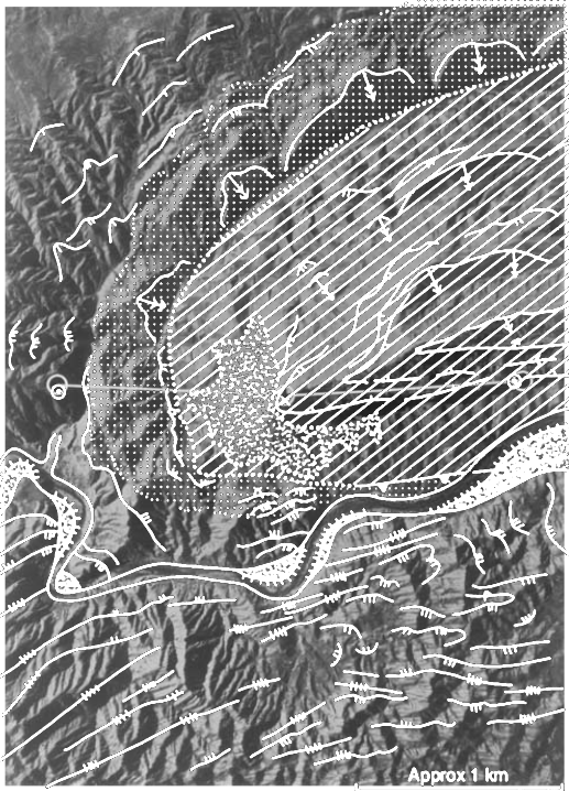
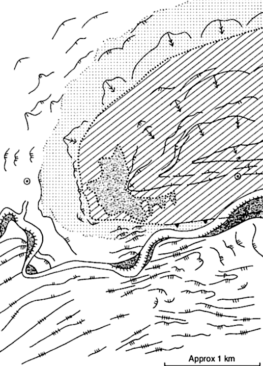
Eulerian
from Frigeri et al., 2004
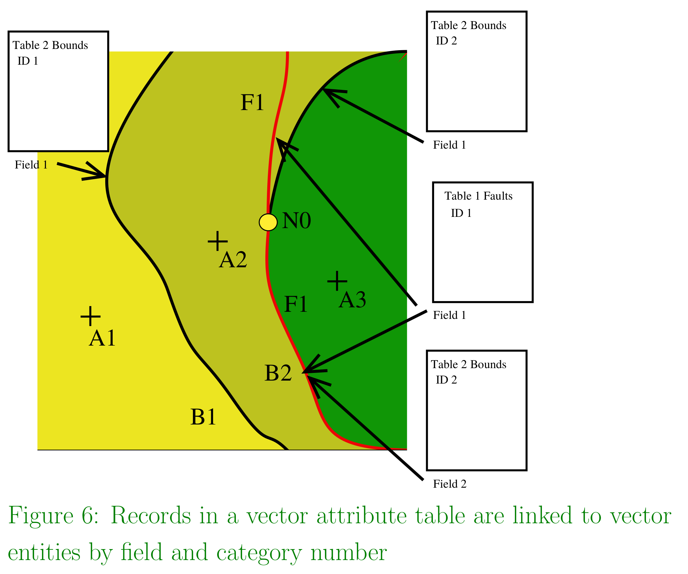
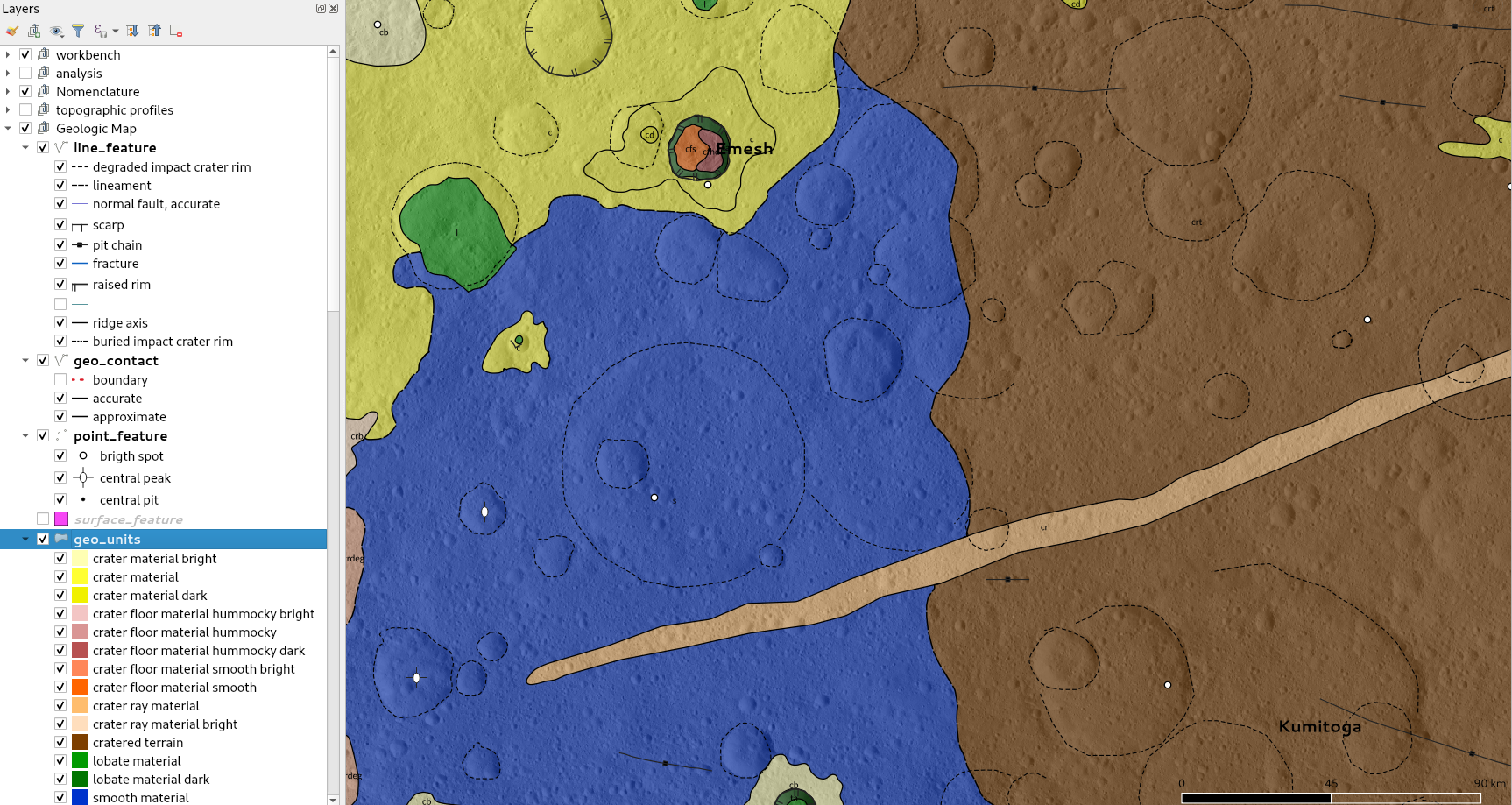
Point/line/polygon
Contacts to Geologic Unit loop
For point/line/polygon paradigm we need a geoprocessing loop
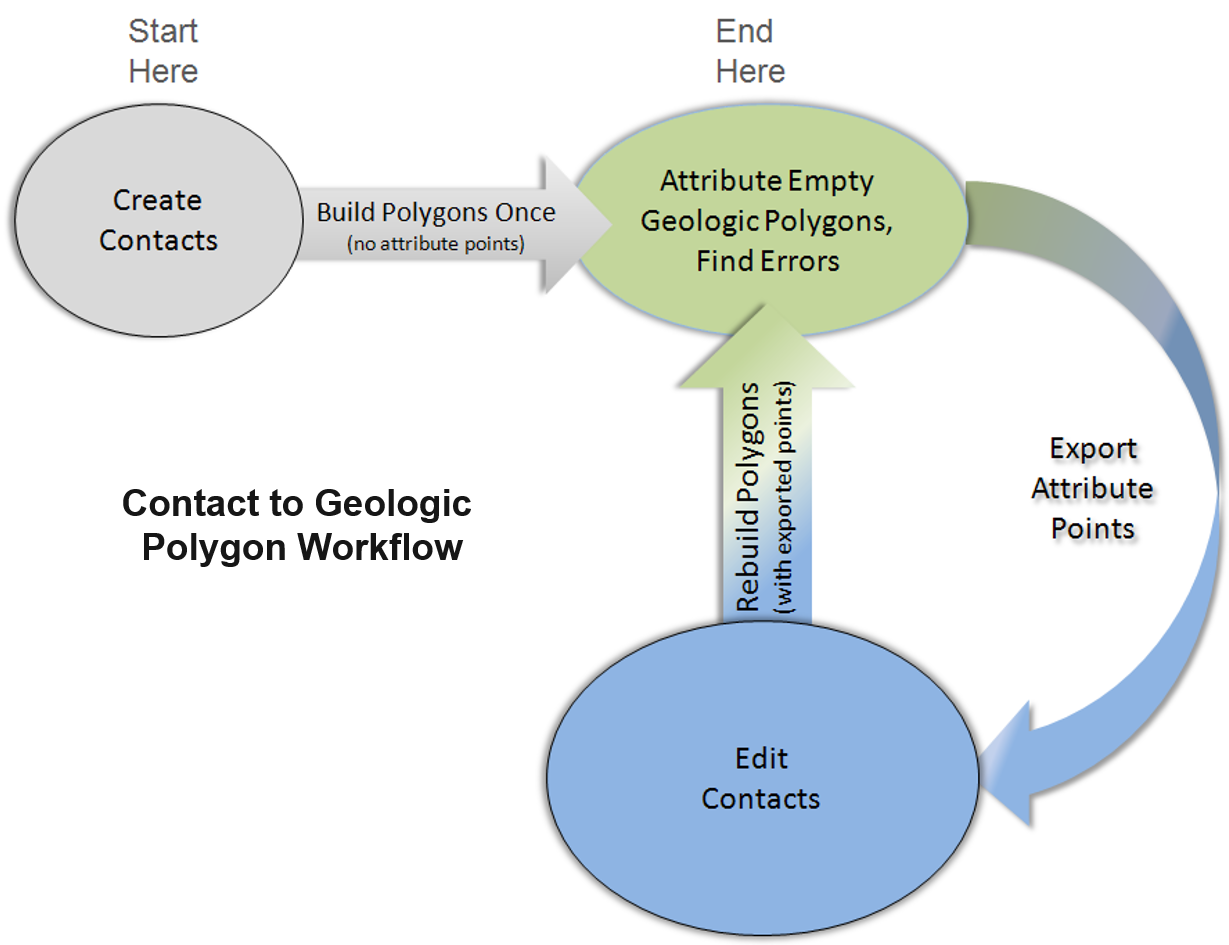
Poster!
- Which are the pro/cons for each model?
- What are the software/tools available?
- Is there some tool/project still needed?
discussion is open at the poster session! alessandro.frigeri@inaf.it